Pics from our June Moab trip

NC_Zuk

New Member
Joined
Jul 14, 2005
Location
Fayetteville, NC
Last month a bunch of us from the Zuwharrie BBS made a trip out to MOab. About half of us had never been before so it made for an awesome trip as we had some great trail leaders. In all we had about 15 different rigs there over the 11 days and carnage was miniman considering the amount of wheeling we got in. If you have never been you owe it to yourself to go as soon as possible. It was worth every penny spent!

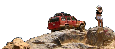
We ran Golden Spike , Gold Bar Rim ,Rusty Nail , Pritchett Canyon , Kane Creek Canyon, Flat Iron Mesa , Upper Helldoarado(Just Aaron on this one) , SteelBender , Hells Revenge , Poison Spider Mesa, part of Behind the Rocks and on Thursday when it was super hot we went up to Geyser Pass . Here are some pics.


normal_HPIM1989.JPG


DSCF0164.JPG

DSCF0020.JPG

DSCF0184.JPG

waynecrack.JPG


rollocrack.JPG
 
GREAT pics!
 
NIIIIIIIIIIIIIIIIIIIIIIIIIIIIIIIIIIIIIIIIIIIIIIIIIIIIIICE... man I guess it is time to pony up and plan a big trip. What is that, 4000 miles round trip? (divided by 10mpg is 400 gallons x 2.35 = $940 in diesel fuel...)

Or...fly out, rent a jeep...Hmmmmmmmmmmmmmm

<---very jealous, thx for sharing the pics!

Sam
 
We usually spend about $1k in fuel for the trip.
 
Awesome pictures, I really like the Orange Zuk, the dukes of hazzard Zuke is :huggy:
the fuel cost amaze me, About 6 years ago I drove from Ca. to Va. in a Sentra SE-R for less than $100 in gas, how much gas prices have gone up is rediculous, a 30mpg car at the time didn't hurt either
 
not trying to be an ass, but did you have permission to ride escolater? i thought it was closed to the public now, i think lions back or mane what ever it is is closed as well.
 
Escalator and Hell's Gate have never been "official" lines. But they are being permitted by the BLM currently. Fences have been placed to protect nearby vegetation (damage due to spectator parking more than anything) and those lines will remain open so long as the fences are maintained.

Lion's Back is on private property. It's open whenever the owners choose.

You should always check with the appropriate authorities first if there's a question, tho. A seasonal/temporary closure could always be in effect, no matter where you're wheeling.
 
NC_Zuk said:
2100 miles, 750 in Diesel is what I spent. Take your own rig and stay atleast a whole week! You will NOT regret it ;)

Which route did you take from here...looks like Mapquest has it going out 70 west thru KS, etc....I would have guessed 40 west would be the right path?

Sam
 
40 is too far south. That's how we usually go out, but only because we cut north through ABQ, Farmington, and Dgo to visit friends. I70 is about 45mins north of Moab.

And Lee: my $1k accounts for about 4500 mi, including a bunch of 6mpg days (both trail days, and driving-uphill-across-OK-with-a-30-mph-headwind days).
 
Metto said:
not trying to be an ass, but did you have permission to ride escolater? i thought it was closed to the public now, i think lions back or mane what ever it is is closed as well.


They are both officially open and as posted above fences have been constructed to protect the nearby vegitation. There are signs plainly visible that explain this aspect.

Yes, Lions back is open. The entrance is on Private land and it costs 10 bucks to go through the gate in a vehicle. It was definately worth 10 bucks :D
 
SHINTON said:
Which route did you take from here...looks like Mapquest has it going out 70 west thru KS, etc....I would have guessed 40 west would be the right path?

Sam


We took 64/70 on the way out and 40 on the way back. going route 40 is about 200 miles longer but we wanted to see different scenery. We took 3 days to drive there and 3 to get back. We weren't in any hurry ;)
 
Nice pics. Maybe one day i'll be able to afford a trip out there.
 
Back
Top