The Saw-Mill re-route will mean a large portion of the trail will be "new", and that is slated for completion in September this year.
Next year the old "Big Branch Trail" is slated to be re-opened. It will largely consist of the old Big Branch Trail with new sections added to route it in accordance with the hydrologists findings etc. I don't know if it will be called the "Big Branch Trail", but I have referred to the "loop-de-loop" by the Forest Service.
As far as gold mine is concerned its up in the air. What I do know is it would a LOT of work to get it re-opened, with a lot of new sections to re-route it around issue areas.
As far as "extreme" trails go here is my understanding. The Forest Service is responsible for providing a percentage of trails for the public use. This falls into 40% Green Diamond Trails (Easy), 40% Blue Diamond Trails (Moderate), and 20% Black Diamond Trails (Most Difficult). And even then their goal is to keep the Black Diamond Trails open to all kinds of traffic, including ATVs/Dirtbikes, stock vehicles etc through the use of bypasses/secondary routes.
While I will agree what we consider Most Difficult out here, doesn't equate to Most Difficult out west. But considering Uwharrie has always been geared towards the stock/mild crowd, it is what it is.
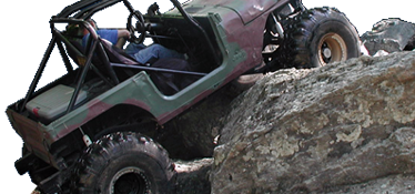
The thing that most people don't want to hear is Uwharrie will never be up to par with the difficulty level of Tellico. The trail system was expanded/formed using bulldozers/heavy equipment. Be it the bike trails that were widened, or new trails carved out. When you use a bulldozer or track loader to cut out a trail its generally flat/fairly smooth grade. Think of the Forest Service roads minus the gravel, or even better most of Wolfs Den.
Take that image of a fairly smooth/hard compacted surface and apply erosion from rain, tires, use etc. You slowly uncover rocks and other obstacles form from the erosion. The Forest Service has to balance an acceptable level of erosion to keep the trails open, while still providing a level of difficulty to keep people coming back. So through trail maintenance the rocky areas and more difficult areas we enjoy for their challenge are filled in.
If Tellico had been maintained to the current level of standards by the Forest Service from the beginning, it would probably look a lot like Uwharrie (and would still be open). For us to reach a level of difficulty even similar to Tellico would require the trails to be left without maintenance for 10+ years. And then they would be in the same situation as Tellico was, facing permanent closure.