
krzyabncanuck
BLM HOTSHOT
- Joined
- Apr 12, 2005
- Location
- Nam
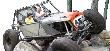
Attached and inserted below is a request for comment on a proposal to permanently close a section of the Rocky Mountain Loop OHV Trail in the Badin Lake Recreation Area in the area known as Kodak Rock. Please review the description and map and provide comments by September 23rd. Thank you for your interest in the Uwharrie National Forest.
Dear Uwharrie National Forest User:
The Uwharrie National Forest is proposing to permanently close, decommission, and stabilize a section of the Rocky Mt. Loop Trail (TR 92) in the area known as Kodak Rock. This project is located in the Badin Lake Recreation Area on the Badin Lake Off-Highway Vehicle (OHV) Trail System approximately 15 miles northwest of Troy in Montgomery County, North Carolina.
The project includes closing and decommissioning an estimated 0.85 mile of the Rocky Mt. Loop Trail between the intersections with Slab Pile Trail (TR 79) and Sawmill Trail (TR 93), with 0.35 mile to be stabilized and rehabilitated within the closed section of trail, from the intersection of Slab Pile Trail to Kodak Rock. Permanent barricades would be installed at the closure points and drainage structures would be installed along with geotextile and fill material to minimize erosion. This section of the trail would be closed in order to protect sensitive resource sites within the area.
Currently, the total mileage on the Badin Lake Motorized Trail System is 16.9 miles. This project would reduce the Rocky Mt. Loop Trail from a current mileage of 2.8 to 1.95 miles. See the attached project area map for the details and location of this project.
If you have comments, questions or concerns regarding the proposed action, you should send your replies by September 23, 2016 to:
Theresa Savery, District Recreation Staff
Uwharrie National Forest Service
789 NC Highway 24/27 East
Troy, NC 27371
tsavery@fs.fed.us
Sent from my SM-G920V using Tapatalk
