justjeepin86
Well-Known Member
- Joined
- Jul 9, 2005
- Location
- Winston-Salem, NC
Updates? How did it go?

They haven't been heard from since.Updates? How did it go?
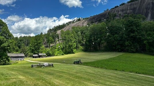
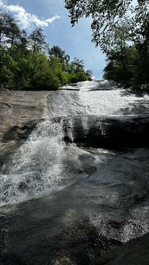
It was alot of fun. We ended up doing about 5 miles and we are feeling it!Updates? How did it go?
I will tell you that towards the end, we thought we were a bit lost and panicked a bit because we needed to leave by 1 at the latest to pick our daughter up from school, and we were getting to about 12:30 and I kept checking my phone to see how much further we had and its like it would never re-calculate and there was hardly anyone out on the trails and we didn't see anyone for about 25 min or so. Ended up getting to our car right before 1, so it all worked out.They haven't been heard from since.
Pro tip - Download Backcountry Navigator or a similar app. Lets you pre-download maps so its local to the phone. Then you can track your location using the GPS, which should pretty much always work anywhere outdoors.... no cell signal needed. Plus then you have a cool record of your trip that you can plot elevation change, distance actually traveled etc.I will tell you that towards the end, we thought we were a bit lost and panicked a bit because we needed to leave by 1 at the latest to pick our daughter up from school, and we were getting to about 12:30 and I kept checking my phone to see how much further we had and its like it would never re-calculate and there was hardly anyone out on the trails and we didn't see anyone for about 25 min or so. Ended up getting to our car right before 1, so it all worked out.